|
|

|
Virtual GPS
Recommended on FDM |
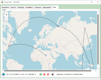
Virtual
GPS is a GPS (Global Positioning System) simulator software.
You can use it to emulate a GPS receiver unit connected to your
computer or analyze various GPS sources. It's ideal when you
need GPS input, but you have no signal or you can use it to
test your GPS applications. It supports various NMEA 0183 sentences,
so it can be used with any GPS mapping software. NMEA 0183 (or
NMEA for short) is a combined electrical and data specification
for communication between marine electronic devices such as
echo sounder, sonars, Anemometer (winds speed and direction),
gyrocompass, autopilot, GPS receivers and many other types of
instruments. It has been defined by, and is controlled by, the
US-based National Marine Electronics Association. It operates
in three modes: simulator mode, file mode and real GPS mode.
In simulator mode the latitude and longitude coordinates are
periodically incremented with a defined step. In file mode the
GPS data is loaded from a text file which contains NMEA 0183
sentences. In real GPS mode the GPS data is coming from a real
GPS receiver.
Supported
Operating Systems:
Attention: Starting with 2018, in order to use the map section, you have to use a valid Google Maps JavaScript API key. You can get it from here for free! After you have it, go to the installation folder, config subfolder, edit the settings.ini file and enter your API key in the GoogleMapsApiKey field. You
can freely use this program within 30 days from the date of
installation. A necessary condition of the further usage of
Virtual GPS is the registration of this product.
The product
is delivered by e-mail. What's
new: - Eliminate
flickering in some parts - TCP server
port support |
||||||||||||||||||||||||||||||||||||||||||||||||||||